Kotabetta
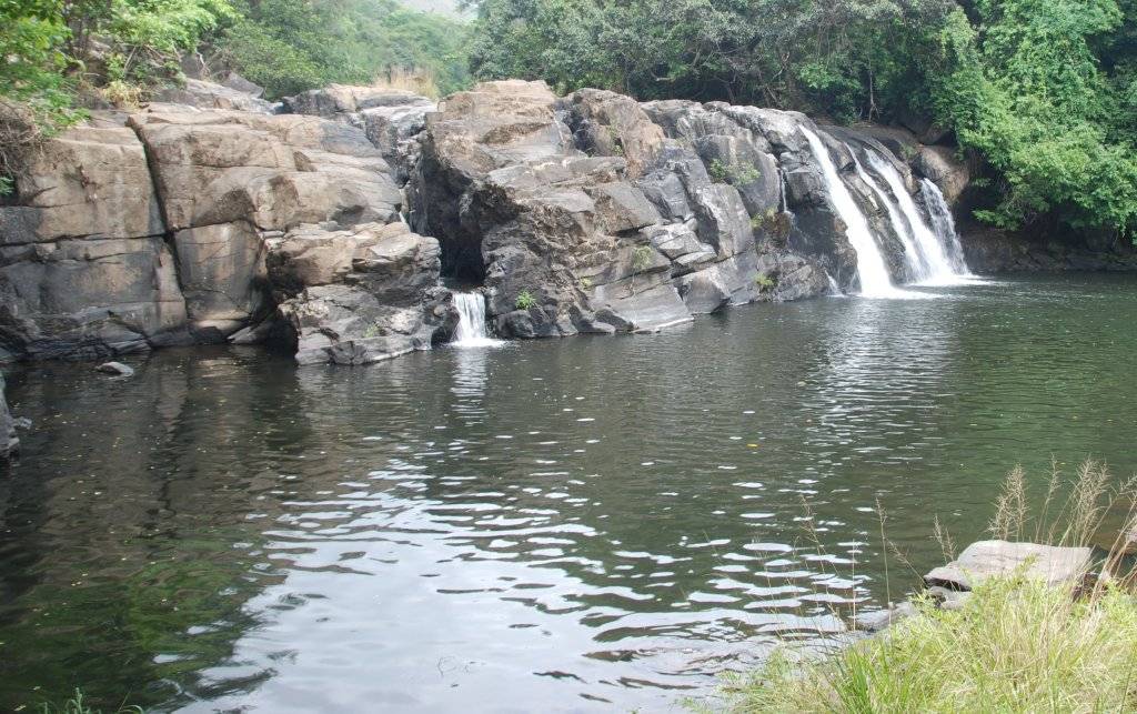
Last weekend, we trekked to Kotabetta. Kotabetta, at 1640m above sea level, is the second highest peak in Kodagu district. It was a fairly easy trek ( ok, ok, for me atleast 🙂 ). We made a short stop at Kottiabbi falls too.
Harsha took care of the logistics, as always, with a twist this time : he delegated local arrangements to VTrack. For good reason : there was a big party to manage - 46 people. One bus and one tempo traveller. VTrack arranged for a guide to show us the way during the trek, plus food and camping.
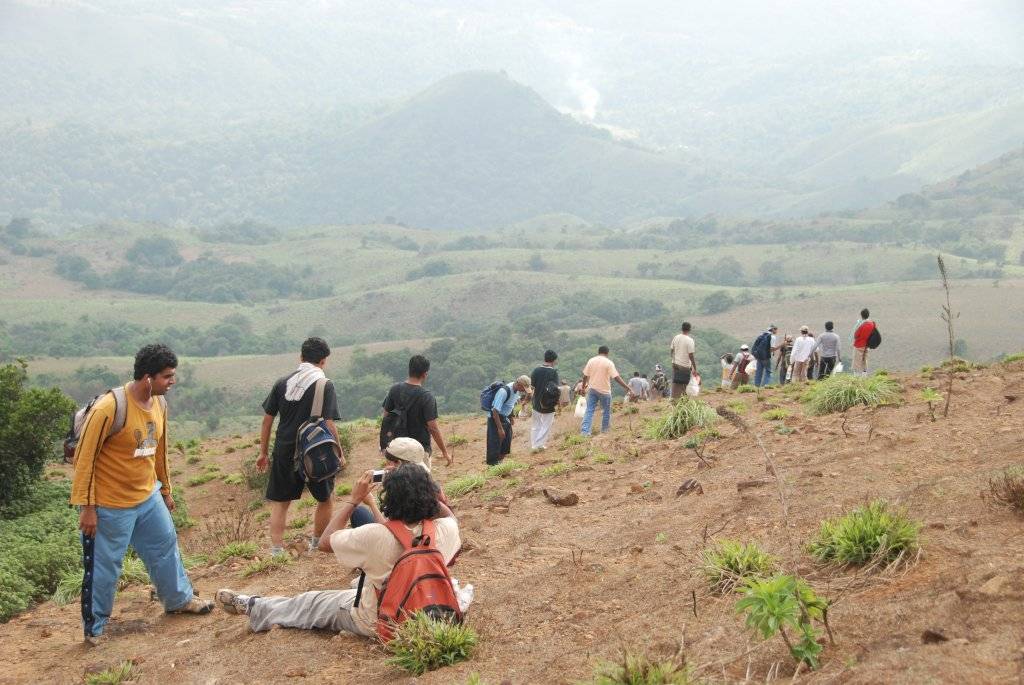
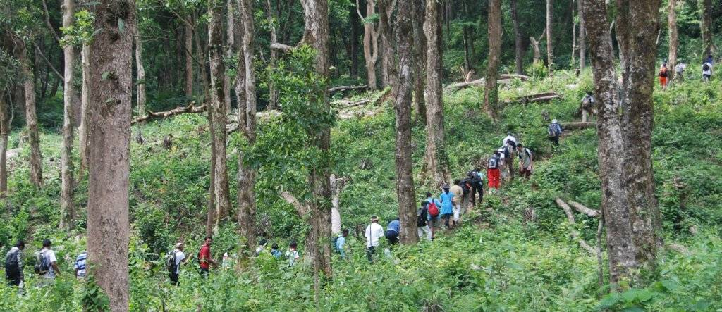
Lot of people meant queues everywhere, and shortage of food. And delay in starting the trek. It was 10:30 AM on Saturday by the time we finally started trekking. The start point was 4kms away from Hattihole (on the Madikeri-Somwarpet road). As expected, the hot sun was out in full glory. The surrounding greenery protected us for quite some time.
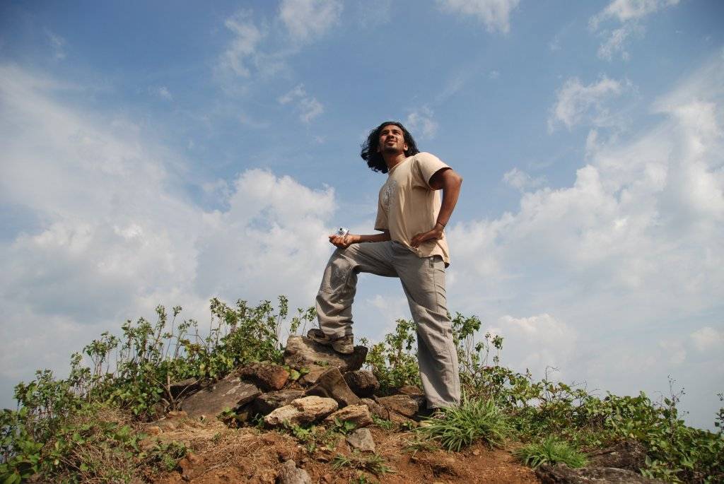
The path was mostly uphill all the the way to the top. The surrounding views (expectedly) became better as went higher. The trekkers kept their cameras busy. And we kept our mouths busy - mainly by talking about anything in sight. Four of us consistently kept at the end of the pack - Harsha, Manohar, Ramya(Manohar's cousin) and me. The idea was to make sure nobody else was left behind. There were mostly first-time trekkers in the group, so progress was slow.
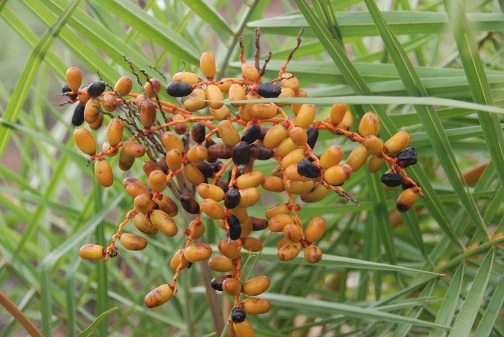
One thing I generally miss on most treks is local fruits - but not this time. Manohar (who is quite the nature observer) was good enough to identify the palm (eechalu in kannada) plants laden with fruits. These are as sweet as dates, but offer only a thin edible peel. Of course, something is better than nothing.
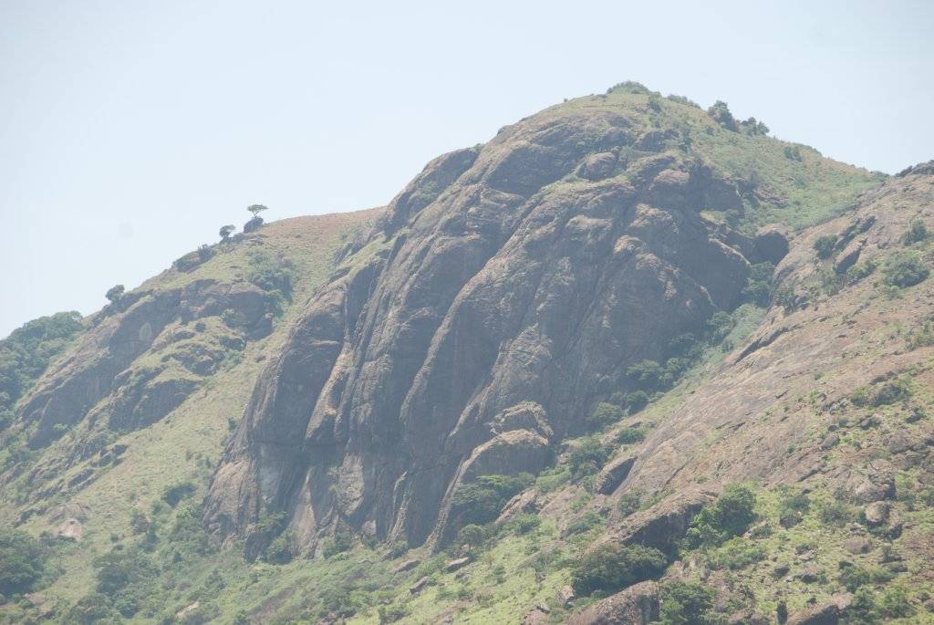
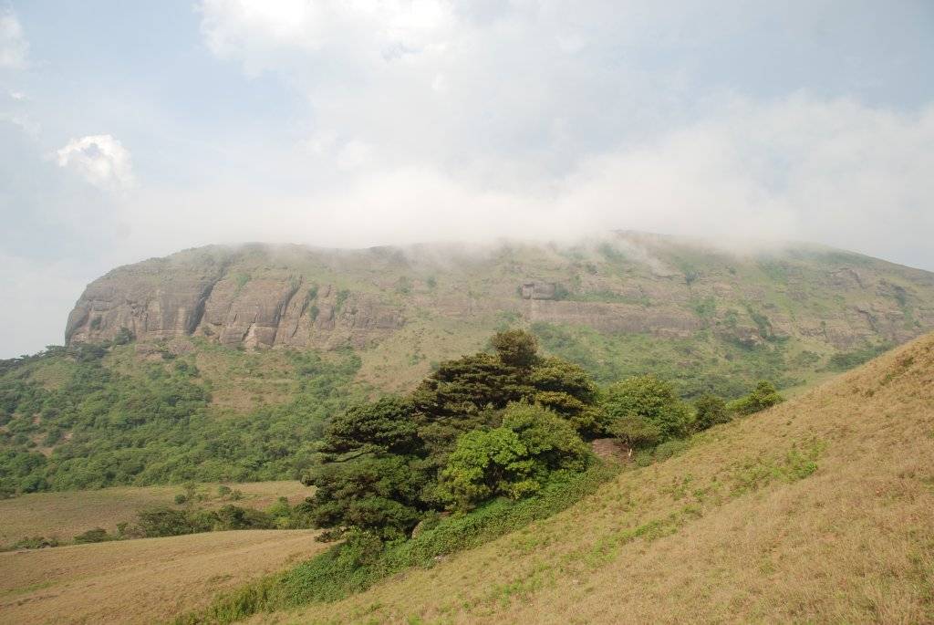
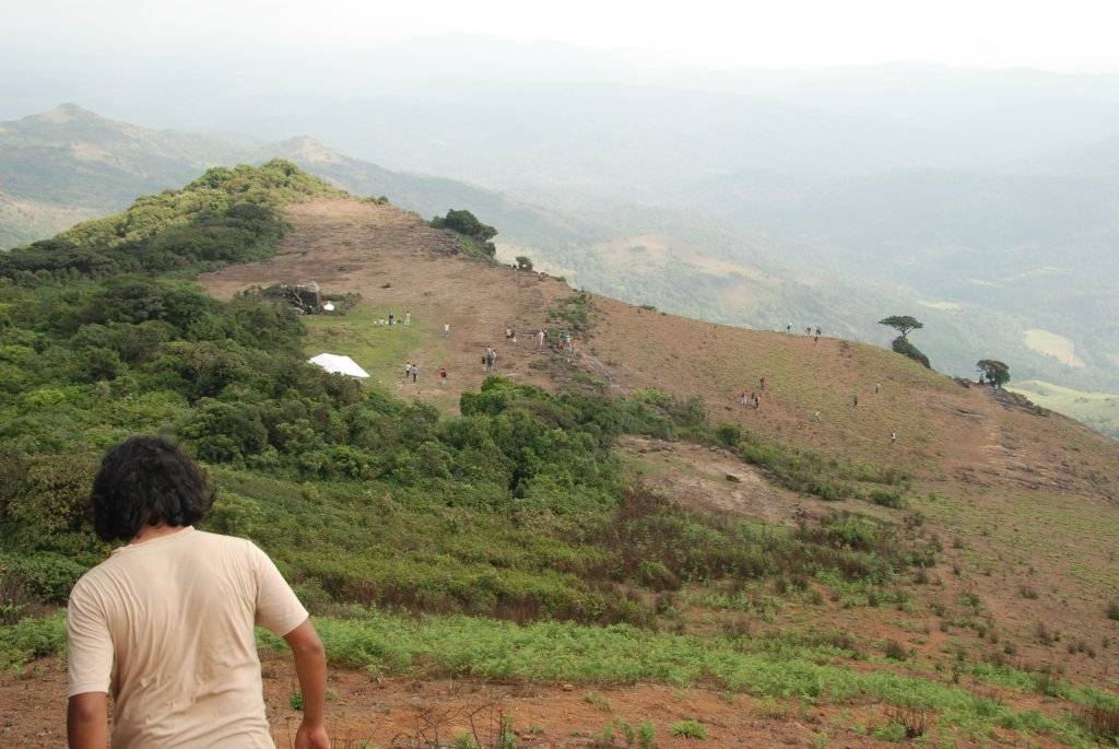
Kotabetta was always in view during the final hour long leg in the march to the top. The curious shape of rocks on one face of Kotabetta seemed to resemble Ganesha. After 4 hours of walking, we finally reached a temple near the peak. Everybody was hungry, and needed no instructions to start eating.
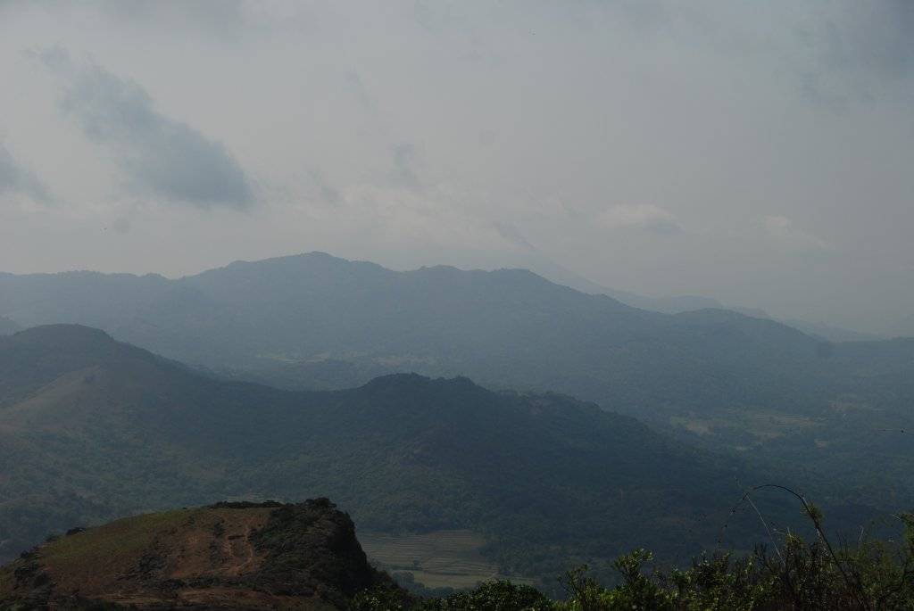
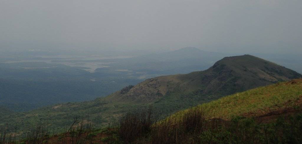
It was getting late, and nobody else was keen to trek to the real top of the mountain. So Manohar and me took twenty five minutes off to trek to the top. The final 75m climb was quite steep. We were rewarded with stunning sights of the surrounding areas - including Pushpagiri, and backwaters of the Harangi Dam. Loose mud on the way down made coming down to the temple trickier.
By 3:30 PM the whole party was on the way down. For an hour or so, it was steep downhill. Nobody was taking chances. As time passed, clouds started covering parts of Kotabetta. And we wished we were there on top to enjoy. But we had to make do with the sights. After the end of the steep incline came gentle climbs and descends for some time. Everybody had their fill of water at a stream inside a wooded patch of land. And we got enough water to put the half kg Tang to use 🙂 A few drops of rain seemed to cool temperatures a bit, but the threat of rain made us walk faster. In the end it all turned out to be a false alarm. We comfortably reached our camping site at 6:30. The last hurdle to cross for the day - a hanging bridge which only two people are supposed to cross at a time.
The camp site was right next to a stream. The stream wasn't in direct view. Large tents (four of them) had already been pitched by the VTrack folks - so one job less for us to do. Tea came at short notice. And dinner was cooked by them, and coffee later. Oh the joys of organized treks!
The bus and tempo traveller, which were supposed to come to a point about half a km away, had refused to come further citing the bad road condition. This was bad, since everybody had a second bag containing all non-trekking items - clothes, plates, etc. So Harsha and three others had to go in a hired jeep to get everybody's second bag containing spare clothes, plates, etc.
Darkness brought its own set of joys. Cooler temperatures for one. And fireflies too. Soon the fireflies combined to create one of the best sights in my memory - blinking fireflies on all the close-by trees. There were countless of them on the trees, blinking in unison. Spectacular! There was also the inevitable antakshari - with many popular numbers being sung.
Dinner was pretty good too - jackfruit palya(subji), some kind of thick sambar, chappati, rice and pickles. After that most people retired to the tents. We spread two of our own (smaller) tents and soon had our own cozy tents ready. Me & Raghu, known snores, had the luxury of sleeping in a three-man tent.
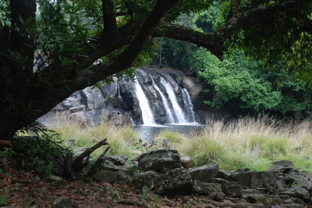
Everybody had a sound sleep. And woke fresher, and lazily in the morning I thought. Coffee was ready (and that seemed to me the best part). The stream close-by was the place for everyone to freshen up. There wasn't much water to swim, so we made do with a good dip. Rice balls for breakfast. And a leisurely hour-long walk to Kote-abbi falls after that!
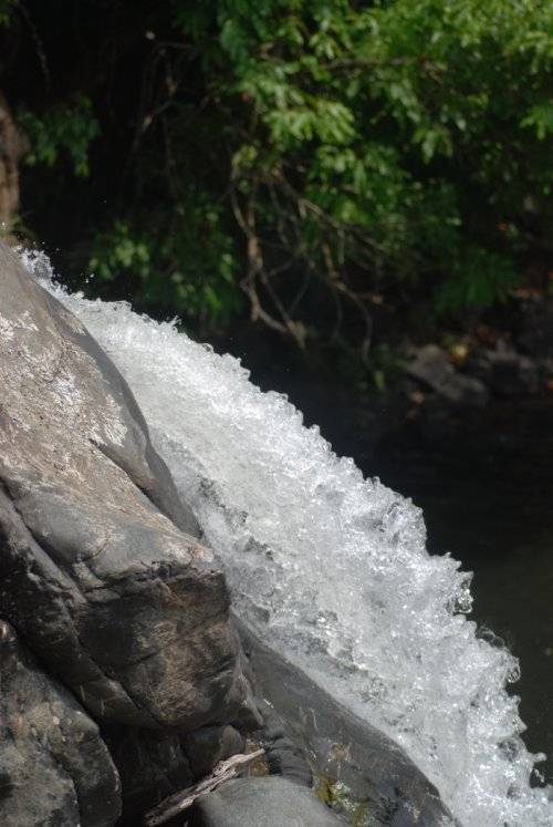
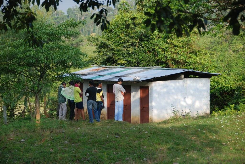
The falls turned out to be a very pleasant place, and had more water than I thought. Good place to finish the remaining Tang 🙂 The last leg of the trek was a 5km walk to Mukkodlu. Mostly village trails and roads. Me & Manohar made merry on fallen jambu nerale(jamoon) fruits - which everybody else seemed to have ignored. The guide lost his way once and the party had to retrace their steps. Few others had gone ahead of the guide, and we had a difficult time shouting to get them back. But otherwise there wasn't much excitement in the last leg. The trek ended at 1 PM near a school in Mukkodlu.
And lunch came soon after. There was much less Palao than needed to feed 47 hungry souls, so the organizers had to be given a bit of stick.
The tempo traveller, which was supposed to come to the spot to ferry us all to Hatti-hole (the bus had refused to come due to the bad road conditions), was nowhere in sight. So 29 of us crammed into a luggage jeep (like the estate labourers) and had a crushing-jumping ride till Hatti-hole. The rest came in the tempo traveller, which was running an hour late!
End of adventure - and all that was left was getting onto the bus and coming back to Bangalore. But not before we had sung our hearts out in the bus & watched the kannada movie "Gaalipata". 10 PM on sunday night, and I was back home and asleep.
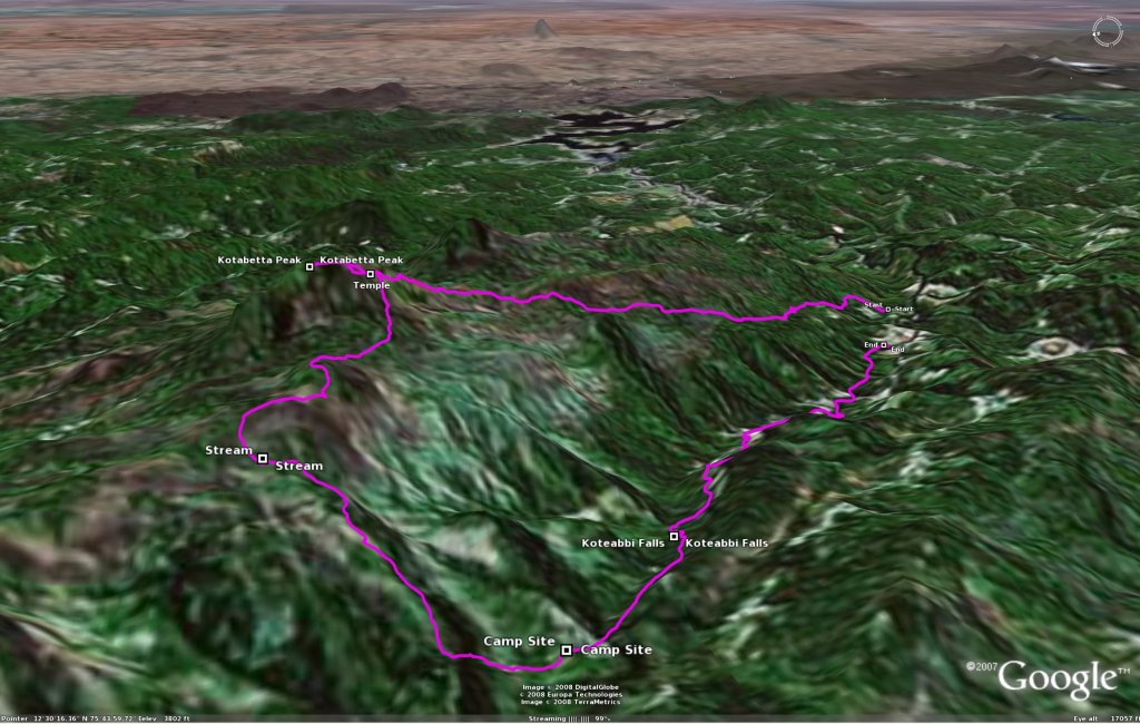
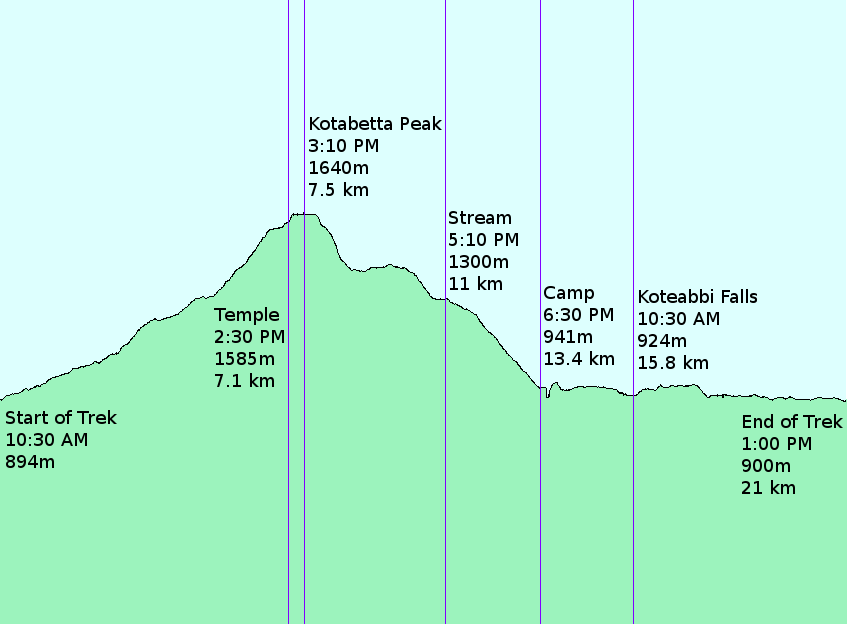
To look at the route we took on Google Earth, click here. If you want to do the same trek, and have a GPS receiver, then our gps track in Garmin gdb format may be useful to you. Please use gpsbabel to convert the file to any other format you need. Also, do have a good look at the altitude profile picture. It has all the important important details.
June 19th, 2008 - 09:49
Nice!! have read & heard (thru Manohar) about your cycling & trekking experiences… keep it up..
will join you people soon on cycling expeditions 🙂
May 30th, 2011 - 04:13
I like the valuable information you provide in your articles. I will bookmark your blog and check again here frequently. I’m quite certain I will learn many new stuff right here! Good luck for the next!